
If so, are we already facing a hydrogeological drought in Kampinos National Park?
Read the response from #ExpertUW, Dr. Maciej Lenartowicz of the UW’s Department of Geography and Regional Studies:
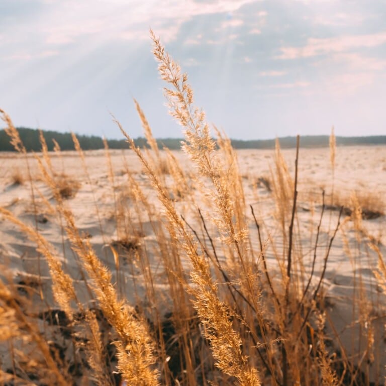
The park’s Biosphere Reserve, National Park and Natura 2000 Conservation Area protect water-dependent ecosystems – which is why the issue of precipitation is so significant to their survival. It may be that a single episode of drought such as we are seeing now can nullify the action of peat-forming processes that have been at work for 5-6 thousand years. years. That is, the deposits of peat that determine the nature of wetlands can be transformed in a few years into something completely different i.e. muck, which is easily eroded by wind if it is over-dried.
However, peat-forming processes are multi-year processes. We define drought in a rather shorter time frame. Certainly at the moment there is an atmospheric drought, that is, we notice the lack of precipitation. Due to the presence of the Warsaw agglomeration and the location of the Park itself in the Vistula Valley, even when weather forecasts predict intense precipitation, it does not mean that it will realistically occur in the Park. The atmospheric front may break up in the Vistula Valley or over Warsaw and the precipitation may be spotty. This was the case during the recent passage of cold weather fronts.
This is not even an issue on the scale of the entire Park, which stretches dozens of kilometers between Warsaw and Sochaczew, but even on very limited areas, because even at a distance of 5 kilometers this variation in precipitation in the KPN can be enormous. Therefore, it is difficult to conclude that after the passage of an atmospheric front with intense precipitation, the problem of atmospheric drought ceases. Well, no, it does not stop.
Second only to atmospheric drought comes soil drought. As late as May and early June, problems with the availability of soil water could already be observed, although no one had yet sounded the alarm. A significant rate of subsidence of the groundwater table has become noticeable. According to my measurements, the water table dropped by up to 10 cm per week. This is quite a lot, considering that after the winter season we started from a state where the groundwater table was above the surface of the wetlands in the spring. And now suddenly it was 60-70 cm below the ground surface. And that’s even without the significant impact of evaporation, as spring has not spoiled us with high air temperatures.
So we could already talk about the beginnings of a soil drought in May, which has certainly already developed quite significantly, especially in locations higher up in the Park. In early June, the flow in the upper section of the Olszowiec Canal, i.e. the main watercourse draining the southwestern part of the Park, disappeared. This marked a clear indication that the hydrological drought is just a step away. Zank outflow on this watercourse is observed practically every year, and therefore its drying up is not automatically treated as a sign of hydrological drought. Instead, the problem is to determine the state of hydrogeological drought, since the circulation of water in the Park takes place in a very complicated system. The Łowicko-Błońska Plain feeds the Park’s wetland ecosystems via an underground route, so this water circulation path is much longer. So even if we don’t have precipitation at the moment, last year’s recharge can cancel out the effects of hydrogeological drought – we can still see atmospheric, soil or hydrological drought on the land surface, but not necessarily hydrogeological drought yet. The inertia of this water circulation system is quite significant.
The impact of the Vistula is also worth noting here. The problem will begin when the Vistula enters a very deep and prolonged low – and that’s close to happening. A deep low is already being observed. It is just not clear how long it will last. If it is long-lasting then, on the one hand, the water table will be low and, at the same time, the previous year’s water supply will begin to run out. Therefore, for the Park area there is nothing worse than a series of 3-4 years without sufficient rainfall, because then this supply from the south of the Park, from the Łowicko-Błońska Plain, can simply run out. This is when it will be possible to call this condition a deep hydrogeological drought. I wouldn’t venture to say yet whether now is the moment, but we may be on its threshold.
What would indicate that this hydrogeological drought may have already occurred?
In fact, some of the watercourses in the Park have already dried up this season. On the one hand, this is a perfectly normal process, as the Kampinos Forest was once a large depression without natural watercourses. It is difficult to demand that the artificial watercourses that are in the Park have a natural character and carry water all year round. If a particular ditch was dug in a place where there was no natural drainage network before, there was a risk that there would someday be a shortage of water that could drain through that ditch. For this reason, it is difficult to determine whether the disappearance of water in a particular watercourse in the Kampinos Forest means a hydrogeological drought,. On the other hand, however, the lack of water in a watercourse always worries and prompts an alarmist tone, since there is never any certainty that the flow will reappear. If it did not appear during periods with traditionally high water levels, such as spring, it would clearly be a sign of hydrogeological drought. And this drought, the emergence of which was preceded by excessive drainage of groundwater by artificial watercourses. A policy of leaving smaller watercourses unmaintained was therefore adopted. Once they disappear, the rate of land drainage will be lower and the risk of hydrological and hydrogeological drought will be minimized. The outflow of water has been slowed down with weirs and levees of various types installed on the main watercourses (primarily on the Weasel), while the ditches have been left untouched in some sections to start overgrowing on their own. The more vegetation present in the channels of watercourses, the slower water will run off, the slower retention will fall, the more water stays in the ground and the risk of hydrogeological drought will decrease.
In view of the above, I would not yet venture to say that we are already in a deep hydrogeological drought, but we may be on its threshold. If this situation of lack of precipitation doesn’t change soon and we only see a series of torrential rainfall, then a prolonged lack of precipitation, followed by torrential rainfall again and again a lack of precipitation – this drought will undoubtedly set in by the end of the summer season, and of this I have no doubt. This could possibly reverse, or rather slow down, some long-term episode of spillover precipitation. If, for example, there is a precipitation period, with high rainfall totals but low intensity, lasting about a week, chances are that along with the precipitation and cloud cover there will be a lower air temperature, which will further reduce evaporation. Under such conditions, waste water that reaches the ground surface of the Kampinos Forest will feed the soil and, consequently, groundwater. This could alleviate the current water resources crisis, and perhaps even reverse at least some of the unfavorable trends.
There is another issue altogether, which is the multi-year trend of falling water tables in the Park area. We notice a series of rain-free years that last for a long time, 3-4 and sometimes even 5 years. The crisis, as in most of the country, began in 2015, when we saw a very deep low on the Vistula in Warsaw for the first time in many years. At the height of Warsaw’s Citadel in late summer, stones could be seen protruding from the river bed. This is the so-called. “Zoliborz Reef. It was then possible to cross the Vistula from one bank to the other without getting more than knee-deep wet. This had its pluses in the form of archaeological finds, e.g. cannons, various kinds of stolen fragments of palace facades, etc. from the time of the Swedish Deluge, but from the point of view of wetland ecosystems, it was definitely not a favorable situation. Unfortunately, this was not followed by any longer period of precipitation, i.e. a series of years with increased precipitation recharge, with a predominance of prolonged rather than heavy rainfall.
What’s more, since that summer, except for one, maybe two seasons, we have not observed significant snow cover in winter. This has been a problem in the Park for the past 7-8 years. This is why the Park’s water resources are not fully restored during the winter seasons. As a result, we have no guarantee that even a week’s worth of spillover rainfall will improve anything. At most, they can slow down this short-term unfavorable trend a bit, but they will not reverse multi-year trends. Measures should be taken to restore and increase around the Park something called small retention, which is the retention of rainwater enough so that it can soak into the ground and, with some delay, find its way into the Kampinos wetlands. On the other hand, measures to stop the lowering of the water table in the Vistula are important. The latter basically covers the entire Vistula River basin up to the mouth of the Narew River and goes beyond the competence of the Park administration, local governments or even the Mazovia Province. Nevertheless, only a combination of positive actions in the immediate surroundings and in the entire Vistula River basin will give a chance for proper protection from degradation and adaptation to climate change of the valuable ecosystems of Kampinos National Park.

Dr. Maciej Lenartowicz, Faculty of Geography and Regional Studies, UW
The post is part of a series on natural heritage entitled “How to Live? – Naturally!”, which was created to draw attention to the need to protect the Earth’s natural heritage.
#naturalheritage #worldheritage #ExpertsUW #unesco #natural